Multi-Disciplinary Coordination

Multi-Disciplinary Coordination (Good Practices) 

These good practices provide a recommended approach on project setup to address model coordination issues across various disciplines and to facilitate effective collaboration, especially across different BIM software. We welcome feedback and suggestions from industry practitioners to help us improve and expand our good practices for industry practitioners' reference and consideration.


2. Use the IFC+SG template and relevant libraries in the tool kit to create the new project.

3. Obtain the Survey Points from the surveyor.


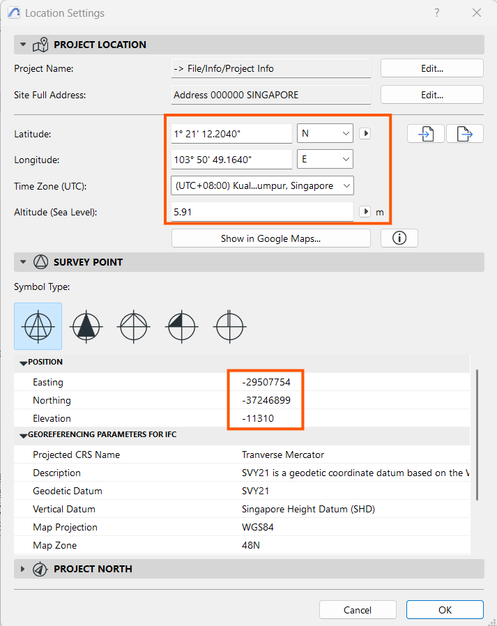
4. Set up the Position as per Survey Coordinates received from the surveyor. This can be set using Project Preferences > Location Settings
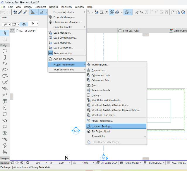
5. Key in the information from surveyor data in the dialogue box as below:
 

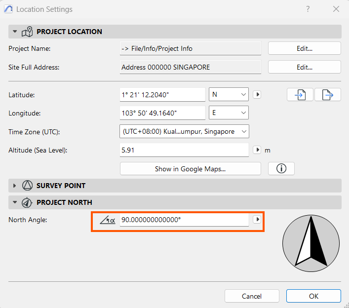
Also, key in the Project North Angle:
 

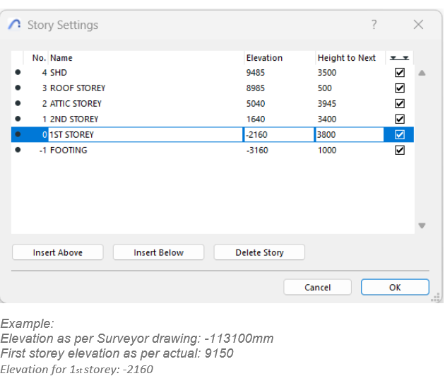
6. From the Project Map, go to the Storey Settings:

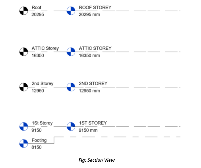
Use the dialogue box below to key in the elevation in relation with the elevation received from the Surveyor in the Storey Settings dialogue box.
 

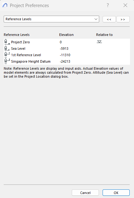
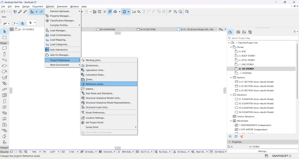
7. Set the correct elevations in Project Preferences for Reference Levels:
Additional settings:
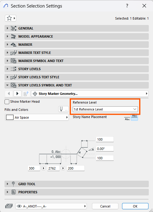
Ensure whenever there is a section or elevation, the reference level is set correctly under the Section/Elevation settings dialogue box:


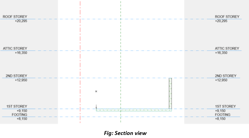
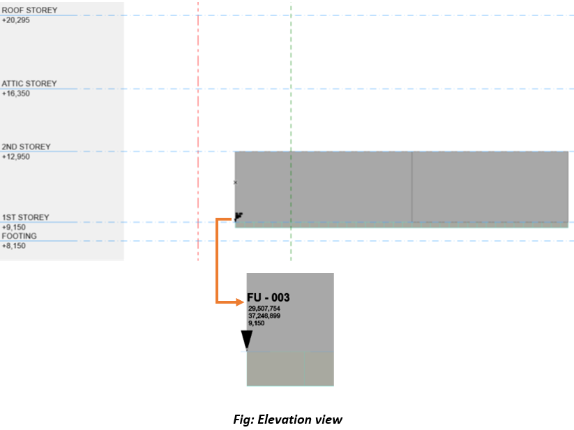
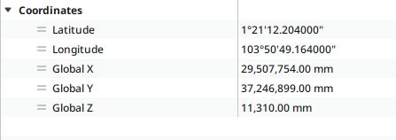
Coordinates should reflect correctly after the above settings as in the example below:
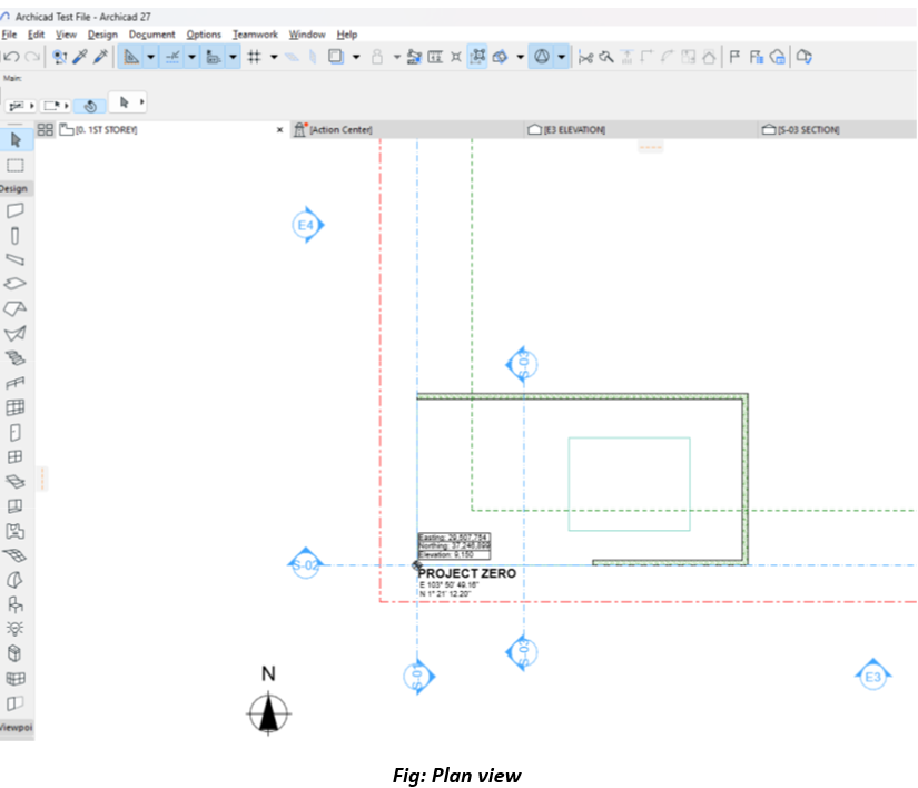


8. Export to IFC:
• Access Export Settings:
- Navigate to File > Interoperability > IFC > Export Options in ArchiCAD.
• Choose the Correct IFC Schema
• Georeferencing
- Ensure Georeferencing Based on Survey Point is selected to maintain real-world coordinates.


1. Obtain Survey Information:


2. Set the Project Base Point:
Specify Survey Point Coordinates at project Base Point without Elevation.

Use the Manage tab > Coordinates > Specify Coordinates at Point. And key in survey point values.
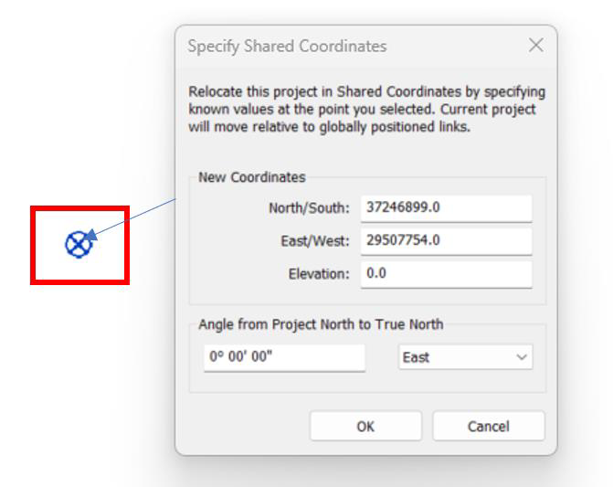
 

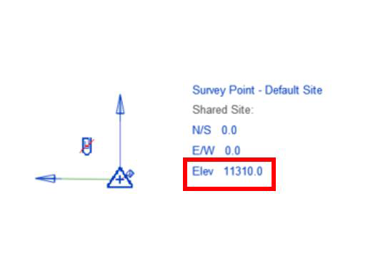
3. Set elevation at Revit Survey point: Enable the Survey Point & define elevation value.
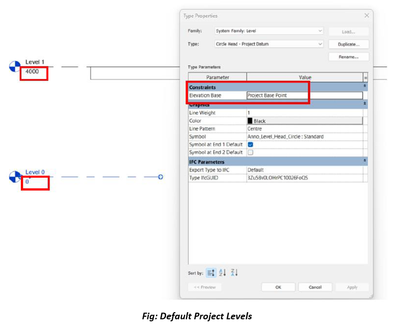
4. Define Project Level and fill elevation value and make sure elevation base is from the Project Base Point.
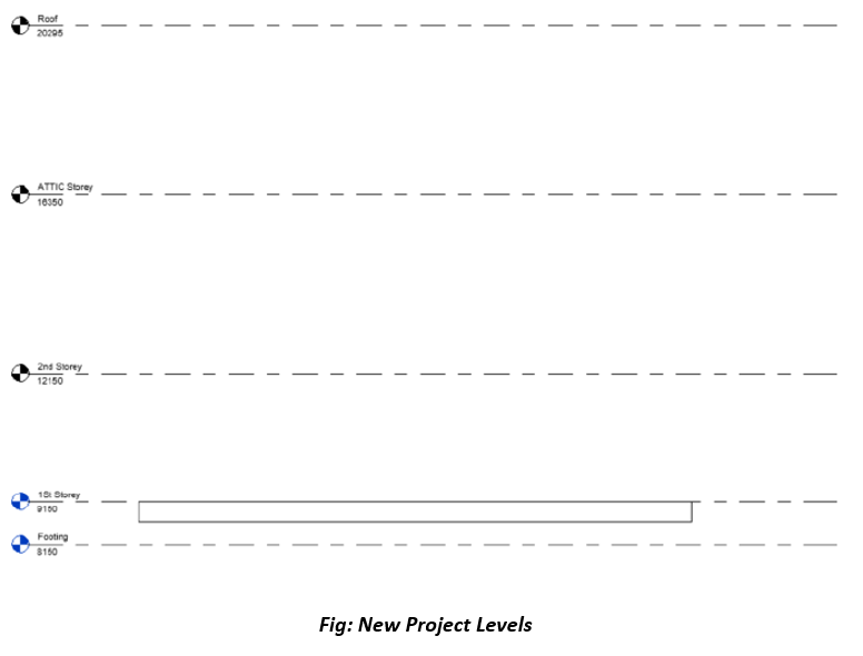
 

Setting Up Project Reference Point Based on Existing Revit Coordinates


1. Set Up a New Revit File:

• Create a new Revit file using the desired template.


2. Link the Existing Revit Coordinate File:

• Go to Insert > Link Revit and link the existing Revit file that has the correct coordinates.


3. Use Copy/Monitor for Grids and Levels:
• Go to Collaborate > Copy/Monitor > Select Link.
• Select the linked Revit file.
• Use the Copy/Monitor tool to copy:
• Levels: Click on the levels in the linked file and copy them to the new file.
• Grids: Repeat the process for grids.

• Ensure to review and match naming conventions and alignment for levels and grids.


4. Acquire Coordinates from the Linked File:
• Navigate to Manage > Coordinates > Acquire Coordinates.

• Select the linked Revit file. This action transfers the coordinate system (Survey Point, Project Base Point, and True North) from the existing file to the new file.


5. Save the New File:

• Save the new Revit file, which now has the same coordinate system as the original file.


6. Export to IFC after linking and verifying alignment, export the Revit model to IFC:
• Go to File > Export > IFC.
• Use an appropriate IFC+SG export setup. (Refer IFC+SG Toolkit for export Setting)

• Ensure the export includes geographic reference set as shared Coordinates
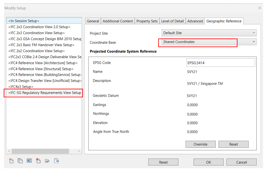
 

Linking IFC File Exported from ArchiCAD into Revit (If Applicable)


1. In Revit, go to Insert > Link IFC

• Select the exported IFC file and link it to the Revit project.

2. Check Coordinates
• Verify that the linked IFC file aligns correctly with the Project Base Point in Revit.

• Use Section and Plan views to confirm alignment.
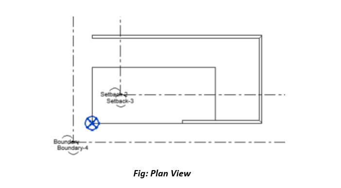
 

3. Export the Revit Model to IFC:
After linking and verifying alignment, export the Revit model to IFC:
• Go to File > Export > IFC.
• Use an appropriate IFC+SG export setup. (Refer IFC+SG Toolkit for export Setting)

• Ensure the export includes geographic reference set as shared Coordinates


4. Compare IFC Files in an IFC Viewer:
• Open both the ArchiCAD-exported and Revit-exported IFC files in an IFC viewer (e.g., Solibri, BIMcollab ZOOM, or BIMvision).
• Verify the following:
Both models are aligned in the same georeferenced location.
orientations, and coordinate systems match between the two files.
Key elements such as levels, grids, and primary geometry align correctly.


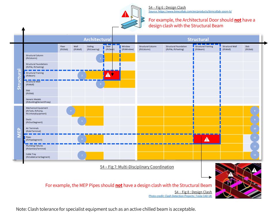
The project team should ensure that in-principle, basic / key components from each discipline do not clash with one another, as indicated in the component clashes matrix below